UN
21 Colston Road
£ 126,000
Description
We don't have a Description for this property.
- Bedrooms
- 3
- Bathrooms
- 0
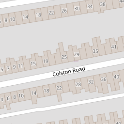

Leaflet © OpenStreetMap contributors
The heatmap indicates the level of crime in the area. The color of the heatmap indicates the crime severity and recency.
Metrics Year-on-Year
- Average area value
- 343,763.00 £Increased by 1.29 %
- Average area rental value
- 1,560.00 £/moDecreased by 6.25 %
- Est rental Yield
- 5.45 %Decreased by 7.31 %
- Crime Rate
- 8.00 %Unchanged by 0.00 %
from 339,393.00 £
from 1,664.00 £/mo
from 5.88 %
from 8.00 %
Nearby Schools
| Name | Type | Ofsted | Distance |
|---|---|---|---|
| Bannerman Road Community Academy | Academy Sponsor Led | Requires improvement | 0.40 KM |
| The City Academy Bristol | Academy Sponsor Led | Good | 0.41 KM |
| Bannerman Road Children'S Centre | Children's Centre | 0.54 KM | |
| The Limes Nursery School & Children'S Centre | Children's Centre | 0.64 KM | |
| The Limes Nursery School | Local Authority Nursery School | Good | 0.69 KM |
Images
Nearby Streets
| Name | Average Price | Average Sqft | Distance |
|---|---|---|---|
| Roman Road | £ 345,000 | 0 | 0.00 KM |
| Brixton Road | £ 340,000 | 0 | 0.00 KM |
| Cato Street | £ 425,000 | 0 | 0.00 KM |
| Ida Road | £ 250,000 | 0 | 0.00 KM |
| Kingsley Road | £ 250,000 | 0 | 0.00 KM |
Nearby Transport
| Name | NLC | TLC | Distance |
|---|---|---|---|
| Stapleton Road | 3250 | SRD | 0.65 KM |
| Lawrence Hill | 3225 | LWH | 0.72 KM |
| Bristol Temple Meads | 3231 | BRI | 2.73 KM |
| Montpelier | 3203 | MTP | 3.03 KM |
| Redland | 3247 | RDA | 4.17 KM |
Nearby Listings
| Address | Price | Type | Score | Distance |
|---|---|---|---|---|
| Colston Road, Bristol | £ 450,000 | BUY | Unknown | 0.04 KM |
| Colston Road, Easton, Bristol BS5 6AE | £ 300,000 | BUY | 4 / 10 | 0.07 KM |
| Colston Road, Easton | £ 375,000 | BUY | 6 / 10 | 0.08 KM |
| Chelsea Park, Easton, Bristol, BS5 6AH | £ 495,000 | BUY | 7 / 10 | 0.10 KM |
| Colston Road, Easton, Bristol BS5 6AE | £ 350,000 | BUY | 5 / 10 | 0.12 KM |
Nearby Properties
| Address | Price | Distance |
|---|---|---|
| 65 Colston Road | £ 312,000 | 0.00 KM |
| 21 Colston Road | £ 126,000 | 0.00 KM |
| 51 Colston Road | £ 232,000 | 0.00 KM |
| 37 Colston Road | £ 129,995 | 0.00 KM |
| 53 Colston Road | £ 325,000 | 0.00 KM |